
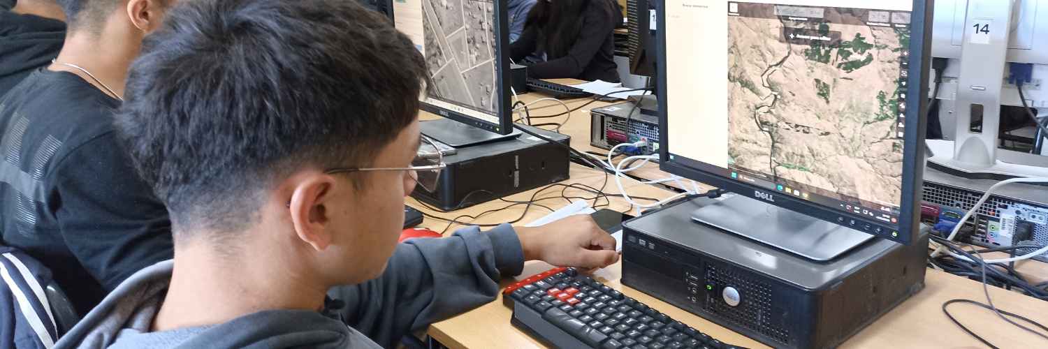
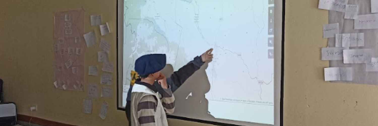
Since the devastating earthquakes on 28 March 2025 in Central Myanmar, many international and local humanitarian actors, including the Humanitarian OpenStreetMap Team (HOT), have been actively supporting the disaster response and recovery. Explore how HOT is working with mappers to address local data challenges.
When the 7.7 and 6.4 magnitude earthquakes struck Myanmar, the global open-mapping community jumped quickly to use the available geospatial datasets of the region to support aid and recovery. However, limited available open geospatial data made it challenging to inform disaster response and recovery efforts. In a fast-paced effort to gather the missing data through OpenStreetMap (OSM), HOT collaborated with the Myanmar OpenStreetMap Community (myOSM), the Centre for Development and Environment of the University of Bern, the Myanmar Branch Office (CDE Myanmar), and more than 3,000 global volunteers to add more than 1 million buildings  and almost 15,000 KM of roads
  , allowing humanitarian actors to have a more complete view of which areas needed attention.
Building on its activation in March 2025, HOT joined other H2H Network members in May 2025 to form a coordinated humanitarian response to Myanmar’s earthquake, with the goal of creating a comprehensive and effective response across sectors. With funding support from H2H Network and UKAID, HOT launched the Crowdsourcing Building Damage Assessments project from May to October to conduct remote building damage assessments in priority earthquake-affected townships. To achieve this, HOT will scale up mapping efforts to additional earthquake-affected townships from Sagaing, Mandalay, Nay Pyi Taw, Bago, and Magway. Townships are prioritised based on (1) their proximity to the epicenter; (2) recommendations by humanitarian actors; and (3) availability of post-disaster imagery. Since May, the project has mapped and validated an additional 8 townships, improving foundational geospatial data to be used for damage assessment.
Through the project, HOT will scale mapping efforts to additional townships (in dark yellow), having completed mapping in 7 townships (in yellow). Townships in states declared under a state of emergency are in white.
“For the first time, we will be able to compare damage detected by crowdsourcing in Myanmar’s earthquake response to other remote sensing damage methodologies, strengthening the field of remote damage mapping.” – Jessie Pechmann, Conflict & Displacement Lead.
Finding #1: Our experience in Myanmar reinforces HOT’s longstanding commitment to strong, open geospatial data ecosystems.
In response to substantial open geospatial data gaps in the wake of the disaster —with OSM buildings data gap at 85.93% in earthquake-affected areas that host an estimated population of 41,670,509 persons— there was a wealth of human-generated and AI-generated building footprint data and damage assessments shared widely to provide an updated picture of the situation in the affected areas. The data has been helpful in initial humanitarian planning, supporting rapid assessments and prioritization.
However, early assessments by HOT also revealed that current machine learning (ML) methods for estimating building footprints are inaccurate and insufficient to close this gap beyond initial response. While rapid ML data can be helpful, in the context of the humanitarian response, HOT remains cautious of the value of unvalidated and inaccurate data, as it risks misinforming humanitarian decisions and could potentially “do more harm”, especially when recommendations are based on flawed data.
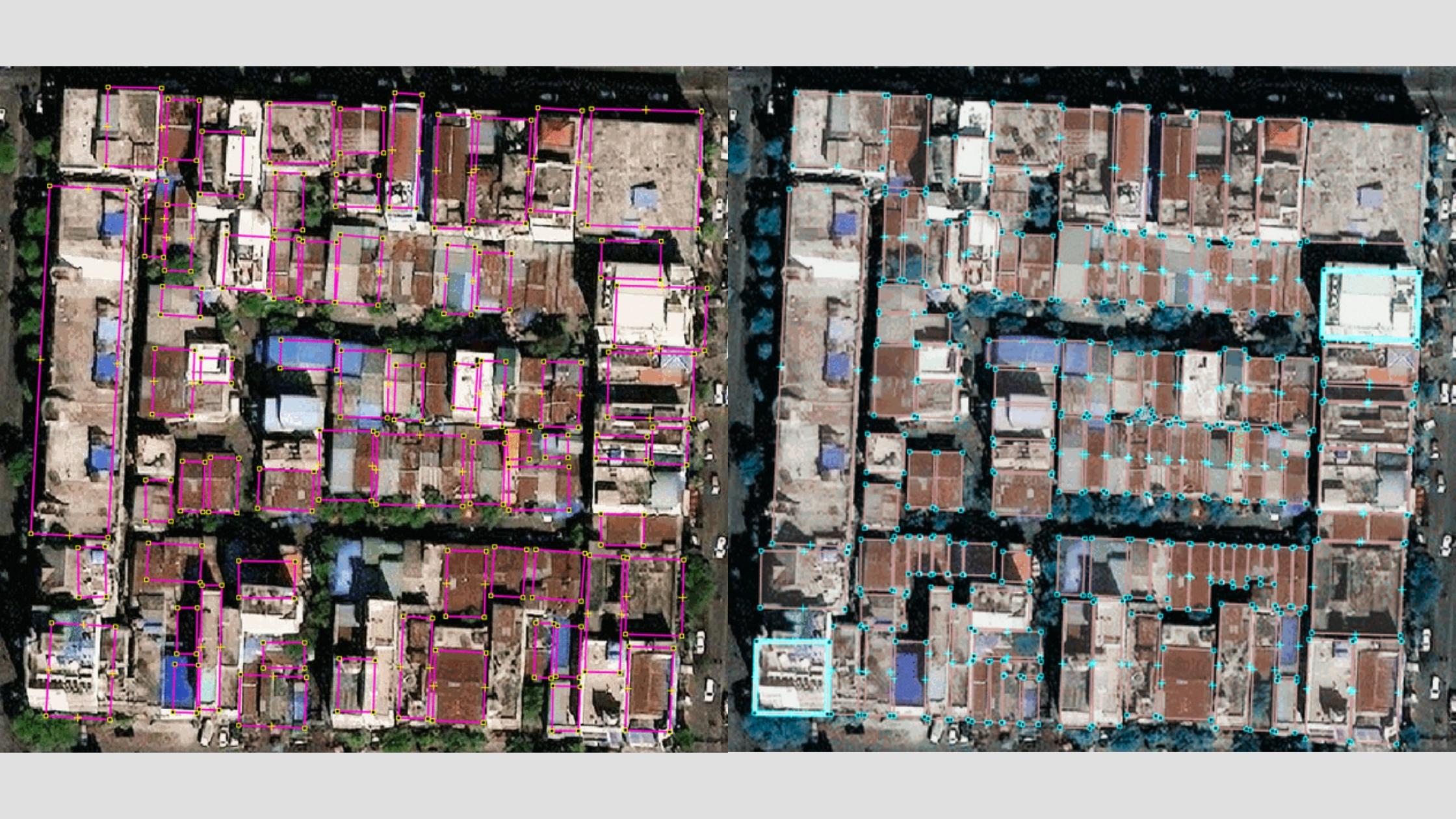
For example, without reliable and available open geospatial data such as validated OSM building footprints, Microsoft AI4G Lab’s AI building damage assessment relies on its AI-generated building footprints, which HOT has preliminarily assessed to be less precise (see figure below), potentially misinforming decisions made by humanitarian actors. This can include overestimating the number of households and aid needed in certain locations.
Comparison of Microsoft AI footprints (left) and OSM updated footprints (right) demonstrates that human-validated mapping is more precise than automated machine learning footprints.
Similarly, incorrect building footprints —in terms of shape, location, and count— are found on Overture data (see below), as compared to manually mapped and validated footprints. HOT continues to invest in strengthening local capacities in open-mapping globally, enabling communities to provide strong and scalable support in contributing, validating, and maintaining open geospatial data, both before and during disasters.
Comparison of Overture footprints (left) and OSM updated footprints (right) demonstrates that human-validated mapping is more precise than automated machine learning footprints.
Finding #2: People-led mapping is still relevant, especially across extensive disaster-affected areas within varying urban and rural contexts.
In rural areas of Myanmar, Overture building footprints distributed early in the earthquake response did not include a large number of settlements that can easily be seen on satellite imagery. HOT’s MapSwipe campaigns, which were launched early in the disaster response, found that one-third of the settlements and building clusters in rural areas are not present in the Overture dataset. Similar findings were noted in HOT’s analysis in Lebanon, revealing up to 65% more buildings in OSM compared to automated ML datasets.
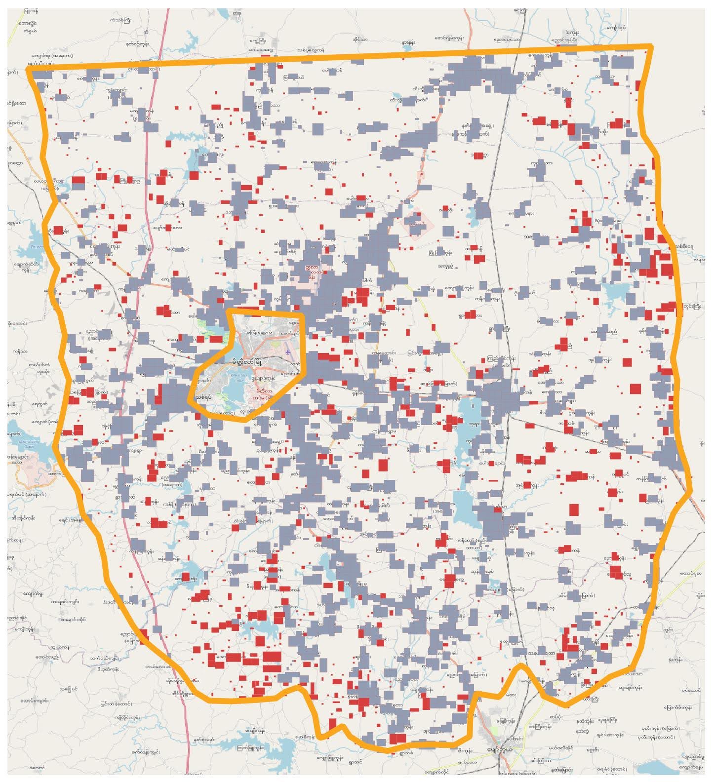
34% of the built-up areas identified in MapSwipe (by humans) around Meiktila, Mandalay Region, had no building footprints present in Overture (red polygons). Grey polygons indicate built-up areas that do contain Overture building footprints. The orange boundary is the extent of the MapSwipe project.
OSM data (left) added through HOT-myOSM collaboration in May 2025 has yet to be completely updated in Overture data (right) when accessed on 28 July 2025.
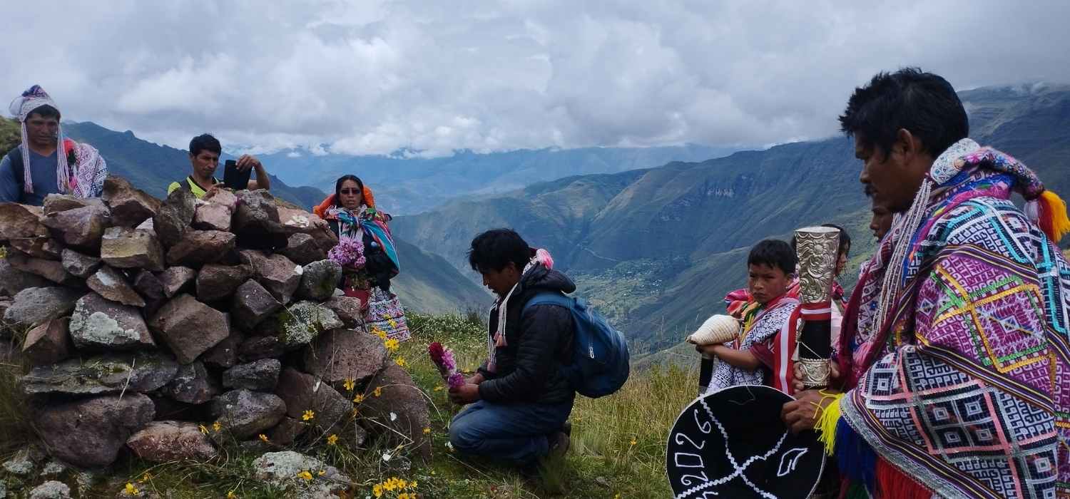
Poor and incomplete datasets risk misrepresenting local populations, rendering a large number of affected populations, already vulnerable, invisible, and potentially “left behind”. In response, HOT is working with local Myanmar mappers from myOSM to rapidly and widely improve geospatial data and conduct building damage assessments across earthquake-affected areas. myOSM’s dedicated contributions have been key in swift mapping progress, ensuring that affected communities are represented on the map.
Finding #3: A damage assessment process that is accurate, reliable, rapid, and scalable is important, especially in disaster response and recovery.
There are multiple existing mapping and damage assessment methodologies that have been applied to support disaster response and recovery efforts around the world. Different methodologies have different advantages and disadvantages, which, when used correctly and at the right stage of the disaster response and recovery, can provide maximum benefits to humanitarian actors.
HOT’s Crowdsourced Damage Assessment (CDA) methodology is being developed as a way to tap into global and local pools of volunteer mappers to identify, map, and validate damaged buildings. It accomplishes this by lowering barriers to entry through open-source and accessible tools, enabling more mappers to be able to contribute, which allows CDA to be conducted in multiple locations in parallel and faster with additional support. The goal is to provide humanitarian actors means to reach as many affected persons as possible, in as short a time as possible, while addressing the shortcomings of various methodologies, including AI-reliant and expert-reliant methodologies.
HOT is currently piloting and refining CDA’s methodology; its outputs will be assessed against other existing damage assessment methodologies to determine its advantages and limitations. This will provide humanitarian actors with a better understanding of different damage assessment tools available to them, enabling them to make more informed decisions on which tool to use for different disaster response and recovery.
Multi-Method Validation
As CDA relies on the wider public to contribute, HOT integrates several open-source validation mechanisms into the process to ensure that CDA can produce reliable geospatial and damage assessment data. This includes, among others:
- Multiple levels of verification;
- Validations of geospatial and damage data by trained mappers;
- Comparison with outputs of existing partner damage assessment methodologies (ongoing analysis by HOT)
An overview of CDA’s methodology, with several open-source validation mechanisms integrated to ensure data produced is accurate and reliable.
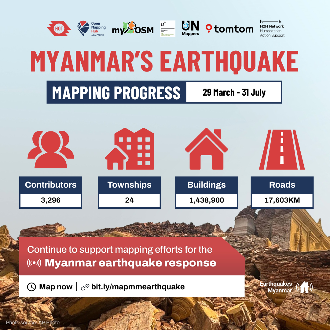
As of 31 July 2025, HOT, in collaboration with myOSM and CDE Myanmar, mobilized 3,296 global and local volunteer mappers to map a total of 24 townships  , 1,438,900 buildings , and 17,603 km of roads .
For interested humanitarian actors, please find access to the dataset at HDX: Myanmar Buildings (OpenStreetMap Export). Interested volunteers can also be a part of this from anywhere in the world – join us as a digital humanitarian today  : bit.ly/mapmmearthquake.
Since Haiti’s earthquake in 2010, HOT has seen the value of working with local communities in supporting disaster response with open geospatial data. Through accessible tools and training, HOT has collaborated with volunteers to produce reliable and accurate data, and more importantly, worked with local volunteers to tap into their lived experiences to ensure that the data is relevant and validated. HOT’s CDA is a new frontier in crowdsourced mapping and taps into the organisation’s long experience to support community-led local disaster response and recovery, typically accompanied by experts and trained professionals. The goal is to offer Myanmar and other disaster-affected regions a two-pronged approach:
- To provide accurate and reliable geospatial data to support and inform ongoing disaster response and recovery;
- To enhance local open-mapping capacities and strengthen access to open-source tools and knowledge to support future disaster response and recovery efforts.
In the following months till October, HOT will continue working with local mappers using CDA to produce geospatial data that informs Myanmar’s ongoing disaster response and recovery efforts. To enhance mapping efforts, HOT, under its Open Mapping Guru Project, launched a tailored capacity-building programme from July to October for 15 Myanmar mappers from myOSM to be trained on supporting damage mapping, with the aim to graduate them as Gurus to support open-mapping initiatives in Myanmar in the long term.
Cover image: “A Street in Bago”, by Go-Myanmar – Own work, CC BY-SA 3.0, https://ift.tt/D3AFE20
from Humanitarian activities – Techyrack Hub https://ift.tt/AuGpx1z
via IFTTT


