
Freetown’s first citywide drone mapping project redefined urban planning by putting communities at the center — piloting drones, producing data, and shaping the future of their city.
Versión en español
Imagine if a city didn’t just get mapped — but mapped itself… In Freetown, Sierra Leone, the mayor and the city council have made this a reality. In a world first, the entire city has been mapped by local city residents trained as pilots, processors, and data stewards using inexpensive, lightweight drones and open source software.. And, although technology is a fundamental enabler in this story, it actually demonstrates a more fundamental shift in how city authorities can leverage low cost, high resolution and community-generated aerial imagery to underpin urban development initiatives.
It was Freetown City Council (FCC) who saw the potential of community drone imagery as necessary data infrastructure for the city and secured funding through an ongoing collaboration with GIZ (Deutsche Gesellschaft für Internationale Zusammenarbeit) focused on disability access improvement work. This local institutional commitment and leadership demonstrates what’s possible when cities view developing their people, knowledge, and data as a strategic infrastructure investment.
Since early 2024, FCC has been working with the Humanitarian OpenStreetMap Team (HOT), and Centre of Dialogue on Human Settlement and Poverty Alleviation (CODOHSAPA / FEDURP) from the Slum Dwellers International (SDI) Network to map Freetown’s informal neighborhoods — areas typically underserved by traditional data systems – in fine grain detail using drones and open mapping tools.
As urban challenges around climate resilience and inclusive infrastructure grew, so did the city’s ambition to develop geospatial data that was essential for making effective decisions.
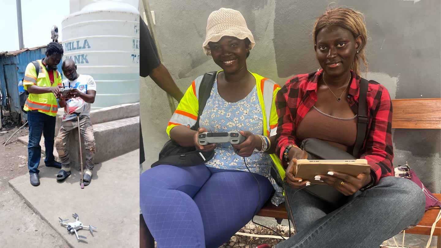
Instead of outsourcing data collection, FCC embedded capacity. With HOT and GIZ’s support, they were able to launch a citywide drone mapping initiative — the first of its kind to be delivered entirely through an open, community pilot model. Of the thirty people initially trained, 14 went on to form the Freetown Open Drone Mapping Crew, including pilots and processors from FCC, CODOHSAPA, OpenStreetMap Sierra Leone and informal settlement residents.
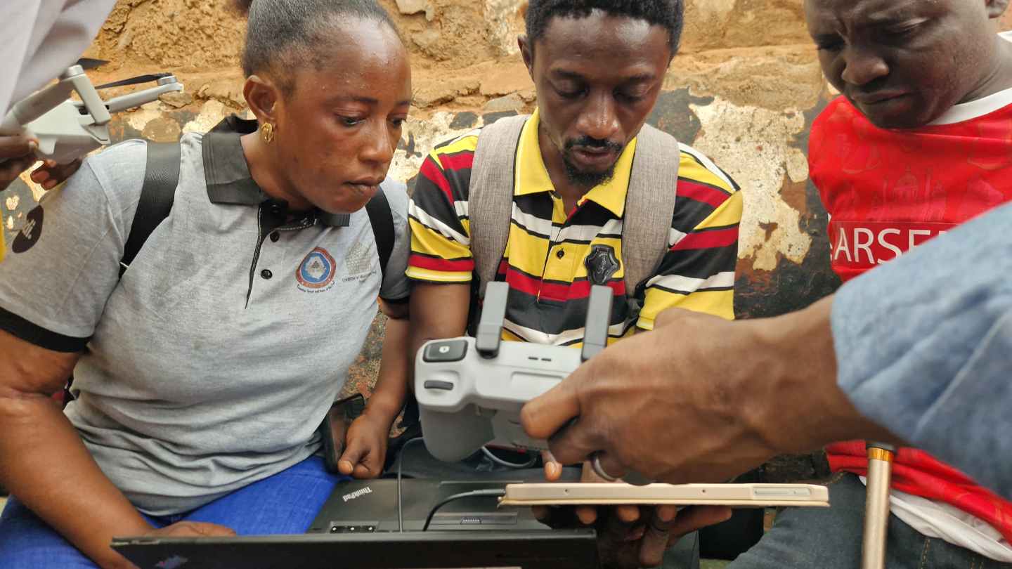
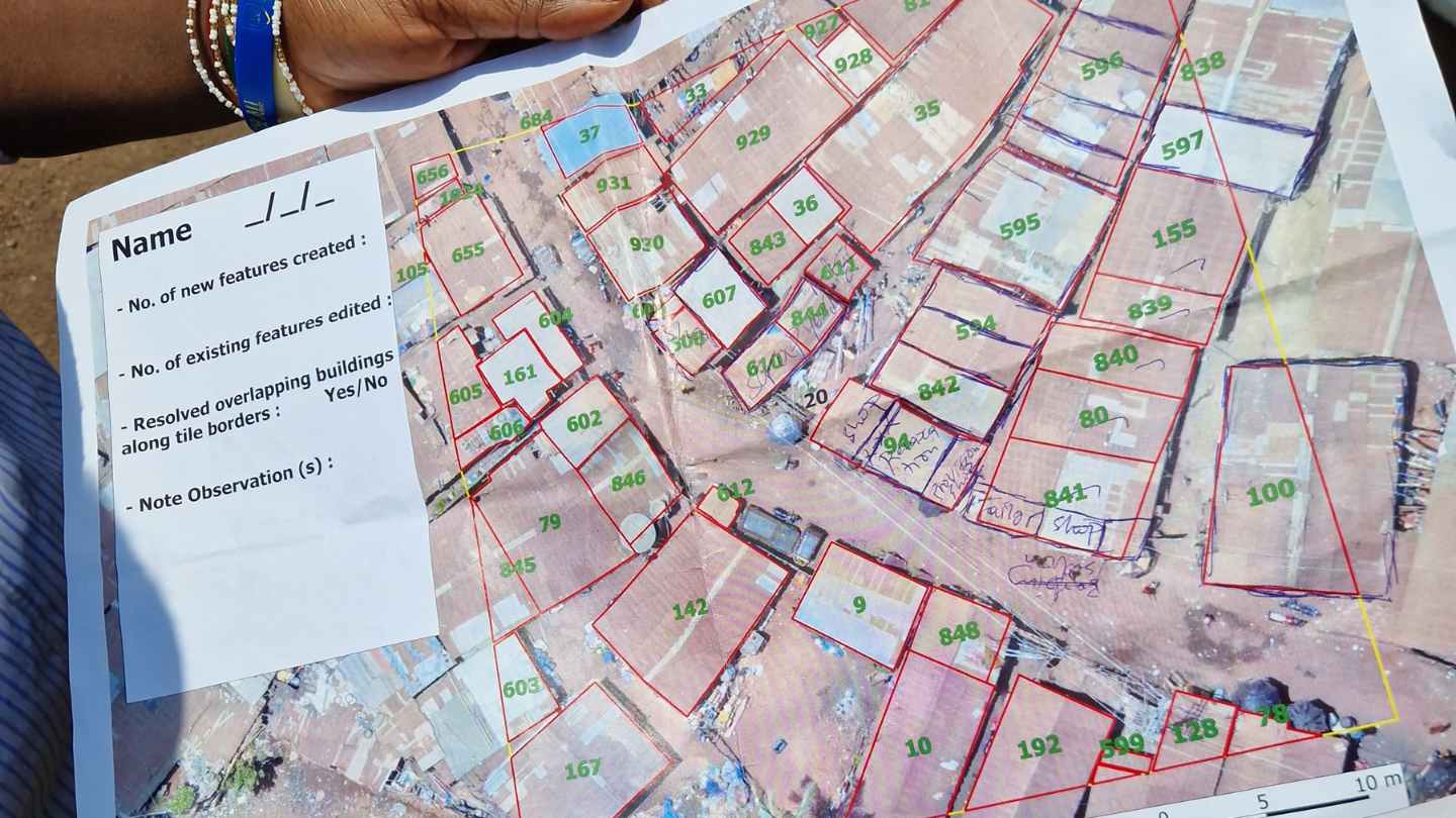
Participants were paid per square kilometer of successfully flown imagery and used open-source tools like OpenDroneMap and OpenAerialMap to generate and share 5cm resolution imagery, 3D meshes, and digital elevation models. Their work is now allowing city authorities and stakeholders to do analysis, planning and implementation of key city interventions — from city-wide solid waste management and central business district regeneration to property taxation and improvement of access for people with disabilities from informal settlements.
Most importantly, their role was not peripheral. This model redefines power dynamics in data production by positioning communities as creators—not subjects—through direct collaboration with their government and the strengthening of local expertise within institutions. Unlike models that rely heavily on external consultants, this approach fosters long-term institutional development, builds genuine local capacity and contributes to local economy and potential.
This model represents a fundamental shift — from dependency to autonomy and from one-off aid projects to embedded local capacity and data sovereignty. Rather than relying on short-term donor grants to fund high-level data creation services, Freetown signed a service contract backed by bilateral funding, recognizing geospatial data as vital public infrastructure. The result: faster execution, lower costs, full local ownership, and flexible replicability.
At the heart of this approach lies a community–municipality–technical partner triad that redefines how geospatial initiatives can be conceived and delivered. Rather than importing one-size-fits-all solutions, the process starts with locally defined needs and leads to co-created, context-specific outcomes. Technical organizations like HOT are not leading from the outside, but supporting from within — acting as facilitators and enablers who align with community and municipal priorities, whether funded directly or through collaborative bilateral support
Importantly, this wasn’t outsourced to external consultants unfamiliar with the local context—an approach that is often more expensive and lacks social responsibility and accountability. Instead, a local team of 28 people — including 10 drone operators from informal communities, 3 municipal staff, and members of local NGOs — were trained, equipped, and paid to fly drones, process imagery, and produce open, accessible geospatial products using tools.
And the demand is growing. Freetown proved that hyperlocal, 5 cm-resolution drone imagery, produced by trained community members, far surpasses commercial alternatives; it is much higher resolution than comparably-priced satellite imagery (which is at best 30 cm resolution) and 3-10x less expensive than piloted aircraft of traditional (expensive) mapping drones. These detailed datasets captured everything from rooftop access to vegetation density, enabling actionable insights for street-level planning, service delivery, housing and services planning, and climate adaptation — delivering data that is 36 times more detailed, dramatically more affordable, and immediately usable for inclusive urban planning, infrastructure delivery, and climate adaptation.
Freetown’s success clearly demonstrates how cities can develop the imagery data they need through an open, cooperative model, where community members are active participants in their city’s data ecosystem. As pilots and data stewards, they don’t just collect information to inform the city’s planning and resilience efforts — they build skills, earn income, and use their experience to improve tools and processes for others.
What Comes Next?
Freetown is putting the data to work. The city has seen firsthand the power of timely, community-generated data, which is now being used to help Freetown prioritize and address key urban challenges — from optimizing waste collection, to restoring mangroves, designing inclusive public spaces, and reimagining the downtown core. This marks a fundamental shift: the city no longer needs to rely on external datasets. It builds its own, following a model that is inclusive, sustainable, and locally driven — and crucially, one that is low-cost, reliable, and easy to replicate or upgrade over time.
Freetown’s open drone mapping crew is ready. Trained, equipped, and embedded in their communities, they now have the tools and skills to respond to future needs — from resilience planning to urban infrastructure and environmental monitoring. This model is not only scalable, adaptable, and affordable — it’s replicable in cities facing similar data gaps and planning challenges across the Global Majority.
Ultimately, this is not just a story about data. It’s a story about trust, capability, and shared ownership. About what becomes possible when cities invest not only in technology — but in people.
This is a call to mayors, ministers, and multilateral partners: Don’t map for communities. Map with them. The future of inclusive, resilient cities starts from the ground up.
from Humanitarian activities – Techyrack Hub https://ift.tt/7v0LQcO
via IFTTT

